The Alberta Clipper storm will affect the area Monday night through Tuesday.
A preview of the system will come in the form of isolated snow showers on Monday morning on a day in which the high temperature will climb into the upper 30s with wind chill values between 20 and 30 as clouds give way to afternoon sun.
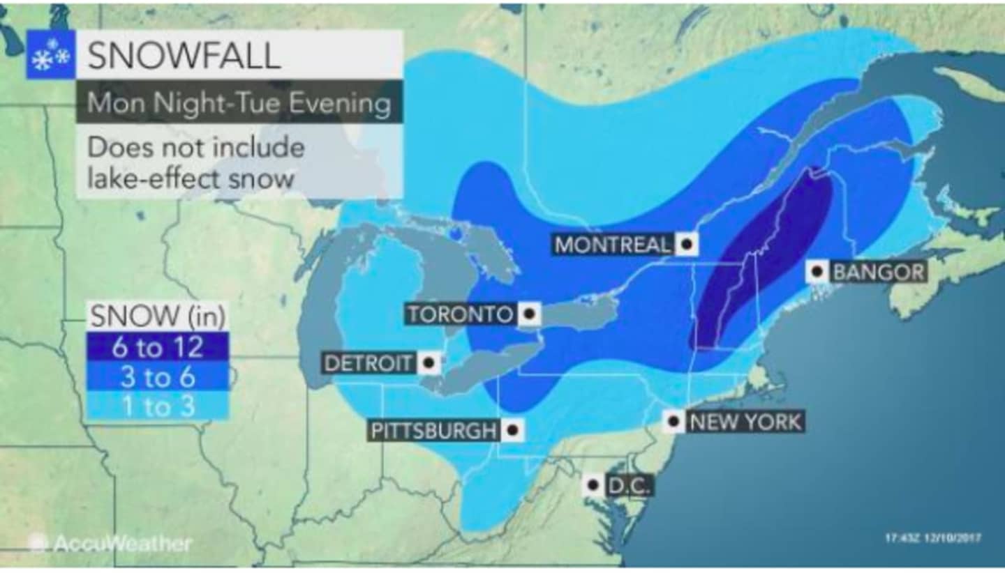
There is a chance of snow between overnight Monday and into Tuesday with a mix of rain and snow likely in the morning in areas farther south with about a half-inch to one inch of accumulation. Areas farther north along the I-84 corridor could see up to 3 inches of accumulation before temperatures climb to above freezing around 10 a.m. Tuesday.
Tuesday's high will reach the low 40s and any precipitation will be in the form of rain starting late in the morning.
Then comes the big chill as high temperatures Wednesday through Friday will struggle to climb above the mid-20s under partly and mostly sunny skies during that span.
Check back to Daily Voice for updates.
Click here to follow Daily Voice East Dutchess and receive free news updates.